

UAV Photographic Survey in Nigeria

The Ultimate Guide to Unmanned Aircraft (UAV) Geographical Data Collection, High-End Aerial Photography
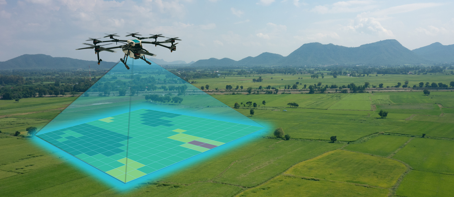
Unmanned aerial vehicles (UAVs), also known as drones, are a growing segment of the geospatial industry. From surveying to construction inspection and asset management, unmanned aircraft systems are being used for an increasing range of applications. UAVs can be used for geospatial data collection because they are capable of capturing high-resolution imagery from above a site. They can also gather information about topography, vegetation, soil type or other factors that can be helpful when designing new buildings or cities, managing resources like water or monitoring natural disasters such as floods or landslides.
How do UAVs collect geographical data?
Unmanned aircraft systems can collect geospatial data in a few different ways. They can use cameras to take photographs that are stitched together to create a high-resolution, wide-angle image of an area. They can also capture high-resolution imagery with a sensor called an synthetic aperture radar (SAR), which uses radio waves to measure the distance between the aircraft and the ground below. In addition, they can use LiDAR to measure topographic features, buildings, vegetation and other elements at the ground level. An example of a UAV data collection project is a survey of a proposed water treatment facility. The UAV could fly above the proposed location and take pictures, which might reveal the presence of vegetation that will need to be cleared. The UAV could also use LiDAR to measure the elevation of the ground.
Where is UAV data collection most useful?
UAVs are best suited to collecting high-resolution imagery in areas that are difficult or impossible for human operators to access. They are often used to survey remote locations that are too far from the ground for GPS positioning systems to have an accurate reading. They are also used to survey areas that are too dangerous for humans to approach, such as forest fires or volcanoes. UAVs are useful for collecting topographical data and other geographical data in areas where vegetation or other conditions make it challenging for traditional survey methods to collect accurate measurements. They can survey areas that are difficult to access on the ground, like swamps, mountains or glaciers. They can also be used for surveying areas that are too dangerous to access on foot, such as volcanoes or unstable buildings following a natural disaster.
Data accuracy and quality issues with UAVs
Accuracy and quality issues with UAVs are closely tied to limitations in the technology. Topographic data is most accurate when collected with LiDAR because it measures ground features in three dimensions. Information is less accurate when collected with cameras, which can only see two dimensions: length and width. Camera quality can vary based on the distance between the aircraft and the object being photographed. UAVs can be used to collect high-resolution imagery, but they must be very close to the ground. This can make it difficult for UAVs to collect precise data about structures, vegetation and other details at the ground level.
Limitations of current UAV technology
While UAVs have many benefits, they face a number of challenges, as well. The lack of a human operator means that ground control cannot be used to troubleshoot inaccuracies in the data. If the drone is off-course or if the data being collected is inaccurate, there is no way to reposition the aircraft. Some UAVs are capable of autonomous flight, but most require an operator to pilot them remotely. It can be difficult to pinpoint the location of a UAV when it is in the air. GPS can give a general location for the aircraft, but it cannot pinpoint the exact place where the data is being collected.
Choosing your UAV for data collection
The type of UAV you choose for data collection will depend on a number of factors, including the size of the aircraft, its range and the type of equipment it can collect data with. For instance, you will want to determine if your UAV can carry LiDAR, cameras or other survey equipment before deciding on a model. Beyond the types of data to be collected, you will also want to consider factors such as the size of the UAV, the amount of space it needs to take off and land, the number of people it takes to pilot the aircraft and how long it can fly without needing to recharge its batteries.
How to integrate GPS and inertial measurement units (IMU) data from a drone
Geospatial data collected by a UAV is often not very accurate. For example, when two different drones fly over the same area and collect data at the same time, their data will not match up. The UAVs will have collected slightly different measurements. However, UAVs can be used to collect data and very precise information from an integrated GPS and IMU. This system uses an IMU and GPS to track the drone’s position. Then, it uses data from other sensors, such as LiDAR, cameras or barometric pressure sensors to collect high-precision, geospatial data. This data can then be uploaded to a cloud data management platform for collection and analysis.
Conclusion
Drones are a growing segment of the geospatial industry and have many uses, from surveying to construction inspection and asset management. They can be used for geospatial data collection because they are capable of capturing high-resolution imagery from above a site. They can also gather information about topography, vegetation, soil type or other factors that can be helpful when designing new buildings or cities, managing resources like water or monitoring natural disasters such as floods or landslides.

LEAVE A COMMENT
You must be logged in to post a comment.