
Survey and Mapping Drones in Nigeria: RTK, Matrice 4E and Survey Deliverables
Talk to us about this service
Trade, import, logistics, sourcing — whatever you're planning, the fastest way to a quote is a WhatsApp message. Our team replies during Lagos business hours.
WhatsApp usYour message tells us which page you came from
A survey drone purchase in Nigeria should start with the deliverables a surveyor or engineer needs: an orthomosaic, surface model, topographic data, stockpile measurement or another specified output. An aircraft advertised as “survey grade” does not, by itself, establish the accuracy of the finished work.
Wigmore Trading can discuss DJI mapping equipment and the supporting package. Tell the team the site, output specification, existing skills and processing system. A clearly defined workflow helps avoid buying a capable aircraft that does not meet the client’s acceptance criteria.
What a land-survey drone can and cannot do
Drone imagery can support visible-surface mapping and repeatable site documentation. It does not automatically establish ownership, legal boundaries or a cadastral record. Boundary and cadastral work needs the appropriate professional and statutory process, with competent survey oversight and suitable ground evidence.
Similarly, a camera looking down at a road or utility corridor is recording the visible scene. It does not reliably reveal buried cables, hidden pipelines or underground voids. If utility detection or subsurface mapping is required, include the relevant ground methods and permissions in the scope.
| Required output | Define before buying |
|---|---|
| Orthomosaic or GIS layer | Resolution, coordinate reference, coverage and file format |
| Topography or terrain | Ground visibility, vegetation, method and control |
| Engineering survey | Accuracy, checkpoints and qualified acceptance |
| Road or railway corridor | Access, airspace, safe operating sections and reporting |
| Boundary or cadastral support | Professional responsibility and statutory evidence beyond imagery |
RTK positioning is one part of survey accuracy
RTK can improve the positioning workflow when properly configured, but positioning accuracy is not the same as the tested accuracy of the final model. Plan the correction source, control points where required, independent checkpoints, coordinate system and processing method.
Ask who will verify the deliverable and what report will demonstrate compliance with the specification. A centimetre-related marketing claim should never replace a project-specific accuracy assessment. Keep the survey method and limitations with the output so that future users do not apply it beyond its intended purpose.
DJI Matrice 4E and mapping packages
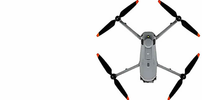
DJI positions the Matrice 4E for geospatial applications, with a mechanical-shutter wide camera among its mapping-relevant features. Compare the complete workflow rather than only image resolution. Clarify corrections, field accessories, software, licences and processing hardware in the proposal.
A team considering the Matrice 350 RTK needs to specify a compatible mapping payload as part of the system. The aircraft body and an RTK label are not a complete photogrammetry or LiDAR package. Confirm payload compatibility and current availability before ordering.
Photogrammetry, vegetation and terrain models
An image-based surface model can include trees, structures and other visible objects. A terrain or bare-earth requirement is different and may need another method or additional survey work. Dense crop or forest cover can prevent optical imagery from showing the ground needed for the intended model.
Ask the survey lead how ground coverage, surface texture, weather and access will affect the method. Establish the required output quality before comparing equipment. A visually impressive 3D model is not necessarily suitable for engineering design or legal boundary decisions.
Construction, road, railway and pipeline corridors
For infrastructure projects, define the corridor, access permissions, repeat intervals and data-sharing requirements. Break the work into safe, authorised operations and realistic capture windows. Flying beyond the operator’s permitted scope is not justified by the aircraft’s transmission range.
Separate visible-asset inspection, route planning, progress documentation and a measured survey. Each has different sensors, personnel and acceptance criteria. A pipeline mapping brief should say whether you need surface alignment, asset condition or buried-asset location; do not sell one as though it solves all three.
Build a complete quotation and handover
Include aircraft, sensor, controller, batteries, charging, cases, correction equipment or services and the required software. Clarify whether processing and training are supplied, coordinated separately or performed by your own team. Agree a sample dataset or acceptance exercise where appropriate.
For a new survey team, plan who will fly, process, validate and approve the output. Confirm current NCAA operating requirements and site permissions before deployment. An equipment purchase or supplier handover is not a professional survey qualification.

Comments are closed.